List of national parks in the Baltics
Appearance
This is a list of the national parks in the Baltic states of Estonia, Latvia, and Lithuania.
Estonia
[edit]There are 6 national parks in Estonia.[1][2]
| Name | Region | Municipality | Established | Coordinates | Area | IUCN category |
|---|---|---|---|---|---|---|
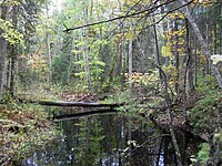
|
Eastern Estonia | Alutaguse Parish | 2018 | 59°06′N 27°19′E / 59.100°N 27.317°E | 443.31 square kilometres (171.16 sq mi) | |
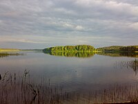
|
Southern Estonia | Võru County | 1993 | 57°42′52″N 26°29′12″E / 57.71444°N 26.48667°E | 123.64 square kilometres (47.74 sq mi) | |
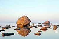
|
Northern Estonia | Lääne-Viru County | 1971 | 59°34′16″N 25°48′1″E / 59.57111°N 25.80028°E | 747.84 square kilometres (288.74 sq mi) | |

|
Western Estonia | Lääne County | 1957 | 58°45′36″N 23°35′49″E / 58.76000°N 23.59694°E | 488.6 square kilometres (188.6 sq mi) | |
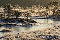
|
South-western Estonia | Viljandi County | 1993 | 58°26′27″N 25°6′20″E / 58.44083°N 25.10556°E | 398.44 square kilometres (153.84 sq mi) | |

|
Western Estonia | Saare County | 1993 | 58°22′43″N 21°52′38″E / 58.37861°N 21.87722°E | 238.82 square kilometres (92.21 sq mi) |
Latvia
[edit]There are 4 national parks in Latvia.[3]
| Name | Region | Municipality | Established | Coordinates | Area | IUCN category |
|---|---|---|---|---|---|---|
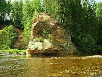
|
Vidzeme | Cēsis, Saulkrasti, Sigulda and Valmiera Municipality | 1973 | 57°25′0″N 25°25′0″E / 57.41667°N 25.41667°E | 917.86 square kilometres (354.39 sq mi) | II |
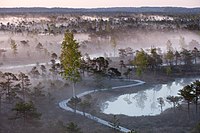
|
Courland Semigallia Vidzeme |
Jūrmala City, Jelgava, Mārupe and Tukums Municipality | 1997 | 56°57′6″N 23°30′45″E / 56.95167°N 23.51250°E | 361.86 square kilometres (139.71 sq mi) | II |
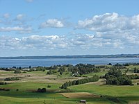
|
Latgale | Krāslava, Ludza and Rēzekne Municipality | 2007 | 56°16′0″N 27°30′0″E / 56.26667°N 27.50000°E | 596.14 square kilometres (230.17 sq mi) | II |
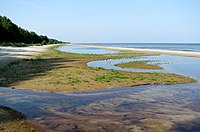
|
Courland | Talsi Municipality | 1999 | 57°37′27″N 22°17′40″E / 57.62417°N 22.29444°E | 163.66 square kilometres (63.19 sq mi) | II |
Lithuania
[edit]There are 5 national parks in Lithuania.[4] They were established in 1991 after Lithuania declared independence from the Soviet Union in 1990. Lithuanian SSR National Park established in 1974 was reorganized and renamed Aukštaitija National Park. Now they cover about 2.3 percent of Lithuania's territory.
| Name | Region | Municipality | Established | Coordinates | Area | IUCN category |
|---|---|---|---|---|---|---|

|
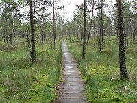
Aukštaitija | Ignalina, Utena, and Švenčionys district municipality | 1974 | 55°20′38″N 26°3′25″E / 55.34389°N 26.05694°E | 410.56 square kilometres (158.52 sq mi) | II |
|
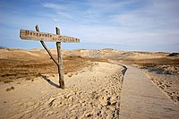
Dzūkija | Varėna district municipality | 1991 | 54°4′55″N 24°22′36″E / 54.08194°N 24.37667°E | 584.53 square kilometres (225.69 sq mi) | II |
|
Lithuania Minor | Neringa municipality | 1991 | 55°28′51.6″N 21°5′49.2″E / 55.481000°N 21.097000°E | 273.89 square kilometres (105.75 sq mi) | II |

|
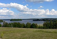
Dzūkija | Trakai district municipality | 1991 | 54°38′20″N 24°25′8″E / 54.63889°N 24.41889°E | 81.49 square kilometres (31.46 sq mi) | II |
|
Samogitia (Žemaitija) | Plungė district municipality | 1991 | 56°2′38″N 21°53′20″E / 56.04389°N 21.88889°E | 217.54 square kilometres (83.99 sq mi) | II |
See also
[edit]- Geography of Estonia
- Geography of Latvia
- Geography of Lithuania
- Protected areas of Estonia
- List of protected areas of Latvia
- List of protected areas of Lithuania
References
[edit]Wikimedia Commons has media related to National parks of Estonia.
Wikimedia Commons has media related to National parks of Latvia.
Wikimedia Commons has media related to National parks of Lithuania.
- ^ Estonia, Europe Protected Planet
- ^ Estonian Nature Conservation in 2007 (PDF). Tallinn: Estonian Environment Information Centre. 2008. p. 29. ISBN 978-9985-881-56-9. Archived from the original (PDF) on 2011-07-19. Retrieved 2009-06-22.
- ^ Latvia, Europe Protected Planet
- ^ Lithuania, Europe Protected Planet

