Battle of La Mesa
| Battle of La Mesa | |||||||
|---|---|---|---|---|---|---|---|
| Part of the Conquest of California during the Mexican–American War | |||||||
 | |||||||
| Belligerents | |||||||
|
|
| ||||||
| Commanders and leaders | |||||||
|
Robert F. Stockton Stephen Watts Kearny | José María Flores | ||||||
| Strength | |||||||
| 607[1]: 192 | 300 | ||||||
| Casualties and losses | |||||||
|
1 killed 5 wounded[1]: 192 |
1 killed 20+ wounded[1]: 192 | ||||||
| Official name | La Mesa Battlefield | ||||||
| Reference no. | 167[2] | ||||||
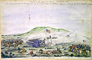
The Battle of La Mesa (also known as the Battle of Los Angeles) was the final battle of the California Campaign during the Mexican–American War, occurring on January 9, 1847, in present-day Vernon, California, the day after the Battle of Rio San Gabriel.[3] The battle was a victory for the United States Army under Commodore Robert F. Stockton and General Stephen Watts Kearny.
Background
[edit]Not finding any Californians at Governor Pío Pico's ranch, the Americans under Stockton and Kearny crossed the plain between the San Gabriel River and the Los Angeles River called La Mesa.[1]: 192 They encountered José María Flores' 300-strong force of Californio militia, including artillery,[1]: 192 near where the city of Vernon now stands, about four miles south of Los Angeles.
Battle
[edit]The Californian guns were ineffective, while the American guns responded from their square as the Americans advanced.[1]: 192 Flores extended his line and brought up two more guns.[1]: 192 Stockton halted and formed his guns into a single battery.[1]: 192 After fifteen minutes, Stockton's fire drove the Californian artillery from effective range.[1]: 192 Flores sent his lancers against the American left flank but were driven back; most of his men deserted, allowing the Americans to advance into Los Angeles.[1]: 192

Aftermath
[edit]The battle was the last armed resistance to the American conquest of California, and General José María Flores returned to Mexico afterward. Three days after the battle, on January 12, the last significant group of residents surrendered to U.S. forces. The conquest and annexation of Alta California was settled with the signing of the Treaty of Cahuenga by U.S. Army Lieutenant-Colonel John C. Frémont and Mexican General Andrés Pico on January 13, 1847.
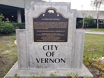
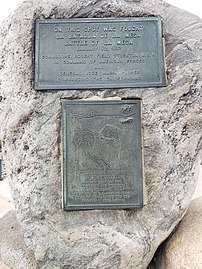
The site of the battle is now registered as California Historical Landmark #167.[2] The marker is located at 4490 Exchange Avenue at Downey Road in Vernon.[2]
California Historical Landmark Marker
[edit]California Historical Landmark Marker No. 167 at the site reads:[4]
- NO. 167 LA MESA BATTLEFIELD - La Mesa Battlefield served as a campsite for the California forces under General Castro in the summer of 1846, during the United States' occupation of California in the Mexican War. The battle of La Mesa, last military encounter of the war on the California front, was fought here January 9, 1847.
See also
[edit]- Los Angeles Union Stock Yards, site of original La Mesa battle historical marker
- List of conflicts in the United States
- Battles of the Mexican–American War
- Captain John Strother Griffin (1816–1898), physician during the battle
References
[edit]- ^ a b c d e f g h i j Bauer, K.J., 1974, The Mexican War, 1846–1848, New York:Macmillan, ISBN 0-8032-6107-1
- ^ a b c "La Mesa Battlefield". Office of Historic Preservation, California State Parks. Retrieved 2012-10-07.
- ^ Hubert Howe Bancroft (1886). History of California, 1846–1848. Vol. XXII. History Company. p. 395.
- ^ "californiahistoricallandmarks.com 167 Battle of La Mesa".
Further reading
[edit]- Bancroft, Hubert Howe (1882). The Works of Hubert Howe Bancroft. San Francisco: A.L. Bancroft & Co. OCLC 2539133.
External links
[edit]- "La Mesa Battlefield - California Historical Landmark no. 167". California Historical Landmark Project Collection. MSS 204. Special Collections & Archives, UC San Diego (library.ucsd.edu). 1936–1940.


